Beijing, Eternally Busy Causing Strife
"Looking at it in Planet Labs [Earth imaging satellite pictures], it looks like China is constructing roads in the valley and possibly damming the river."
"There are a ton of vehicles on both sides [of the Line of Actual Control -- LAC] -- although there appear to be vastly more on the Chinese side."
"I count 30 to 40 Indian vehicles and well over 100 vehicles on the Chinese side."
Jeffrey Lewis, director, East Asia Nonproliferation Program, Middlebury Institute of International Studies, California
"There is the larger picture of the asymmetries of power."
"China’s GDP is $14tn, India’s is less than $3tn. China spends nearly $220bn on the military but India spends $52bn."
Srikanth Kondapalli, professor of Chinese studies, Jawaharlal Nehru University, New Delhi
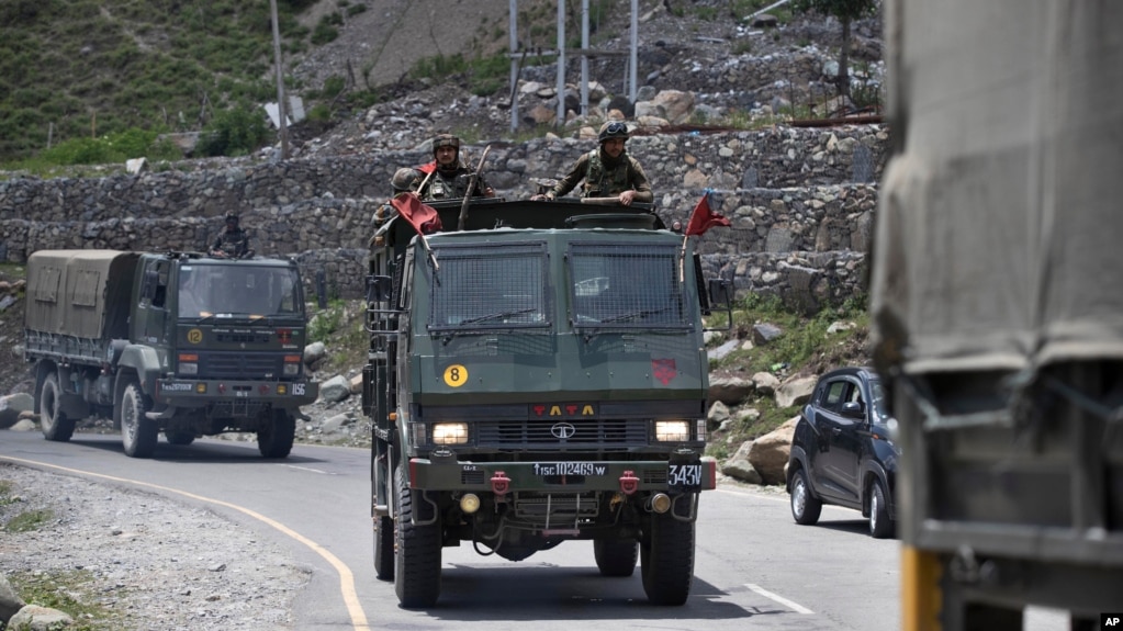 |
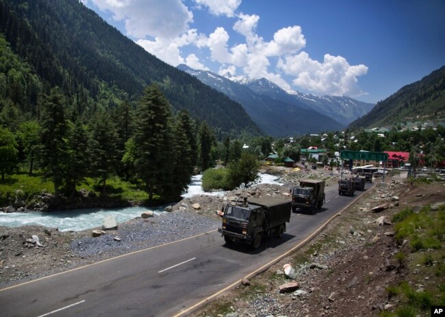
| An Indian army convoy moves on the Srinagar- Ladakh highway at Gagangeer, north-east of Srinagar, India, Wednesday, June 17, 2020. |
From the South China Sea, where Beijing confronts the interests of its neighbours in disputed territories to claim them as their own, to the magnificent and dangerous heights of the Himalaya, wherever the Chinese Communist Party perceives its interests in enlarging its geographic and political territories, it acts with no regard to the outcome. Two of the most populous nuclear countries in the world share a 4,056-kilometre border that runs past glaciers, deserts of snow and freezing rivers where both countries claim sovereignty beyond the border.
Initial, brief skirmishes where both China and India post army stations at 4,300 metres in the western Himalaya have recently taken place by unarmed soldiers on each side. Unarmed, due to a mutual agreement by both sides to keep the prospect of deadly violence to a minimum. Instead, the military personnel on both sides used clubs and improvised weapons and their fists. And given that they're poised on the side of steep mountains, in some instances brute force to send an adversary to his death below.
India has declared the loss of 20 of its soldiers, while China has chosen not to release any information about its losses. "They [the Indian side] deliberately launched a provocative assault, leading to an intense physical clash that caused death and injury", charged Chinese military spokesman Zhang Shuili, insisting that the Indian military was responsible for the hand-to-hand combat, where reputedly clubs covered in nails or barbed wire were used by the Chinese. Which sounds a lot like premeditation.
 |
On the other hand, satellite images now make it clear that in days leading up to the border clash China had brought in heavy pieces of machinery, had cut a trail into a mountainside and according to satellite imagery, may have dammed a river. Both countries rely on seasonal glacier melt and rivers for irrigation and potable water as it makes its way down the mountainsides to the valleys below. Any such alterations are certain to have an effect on both sides; one positively, the other negatively.
The Galwan Valley, where the altercation took place, is an arid, inhospitable landscape, with soldiers deployed on steep ridges, but vital since it leads to the Aksal Chin, a plateau claimed by India, and controlled by China. Signs of the landscape being altered, with the valley showing tracks being widened, earth being moved and river crossings are evidence of Chinese actions not shared with their Indian counterparts. Yet a Chinese Foreign Ministry spokesman claims to be unaware of anything specific occurring.
Zhao Lijian, speaking for the Chinese Foreign Ministry, reiterated that Chinese territory had been penetrated by the Indian Army in several places, demanding their withdrawal. Two Chinese tents and observation towers had been discovered by an Indian patrol, built on its side of the LAC, according to government sources in New Delhi. Although military officials of both sides had reached an agreement to deescalate on June 6, China had proceeded to erect a 'structure' on India's side of the LAC.
The patrol had arrived at a ridge in verification that the Chinese had moved their troops back from the LAC as claimed. In moving back Chinese troops left behind the two tents and observation posts so the Indian party demolished the towers and burned the tests. According to the satellite images no such structures had been seen the week before, on the ridge. The arrival of a large group of Chinese soldiers confronting the Indian troops led to the deadly melee.
 |
Labels: Border, China, Confrontation, Himalaya, India, Strife
posted by Pieface @ Sunday, June 21, 2020
![]()
![]()

<< Home